Welcome to the home of the
Our vision is help our rivers THRIVE. Positive change will ensure our rivers and their wildlife are better valued and protected into the future. The rich heritage, ecology, history and amenity value of our rivers will be appreciated by people, communities, and decision makers.
Click the image below to learn more about DCRT, or scroll down to learn about the Don Catchment.

About DCRT
What is the Don Catchment?
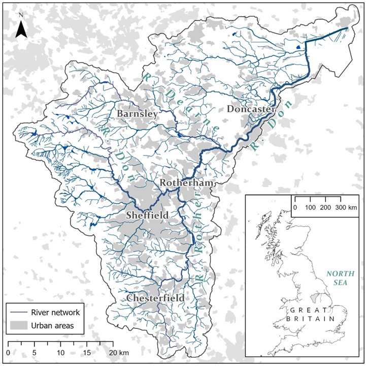
The Don Catchment is the area in which we work. A catchment doesn’t have geographical boundaries, instead it is an area of land that is determined by natural features such as hills or mountains. Water runs off the high ground and flows to a low point, like rain on a roof flowing to a drainpipe. Low points include any body of water such as a stream, river, lake, estuary, wetland, sea or ocean.
For instance the Danube catchment in Europe runs through 10 countries and covers 801,463 km2 (309,447 square miles)! In the case of the Don Catchment the water flows from the hills of the Pennines and Peak District covering 1,700 square km2 (700 square miles). All the water then eventually flows into the River Don, hence why we are called the Don Catchment. It then meets the Ouse near Goole and shortly after, the Humber Estuary and the North Sea.
The catchment covers West and South Yorkshire, Derbyshire and a tiny part of Nottinghamshire and it’s main rivers are the Don, the Dearne and the Rother. The catchment also contains lots of smaller rivers, becks, brooks and streams such as the Loxley, Dove, Went and Rivelin to name a few.